I just a post on FB that iGUIDE is now offering site plans for $35 add-on. Any details about this?
I’ve done two as part of the beta. It ends-up being an extra page on the jpegs. Looks good, particularly when aerials are not part of the package or there is a large canopy where you can’t see the exterior details. It looks really good when included as part of the soon-coming branded property into-sheet.
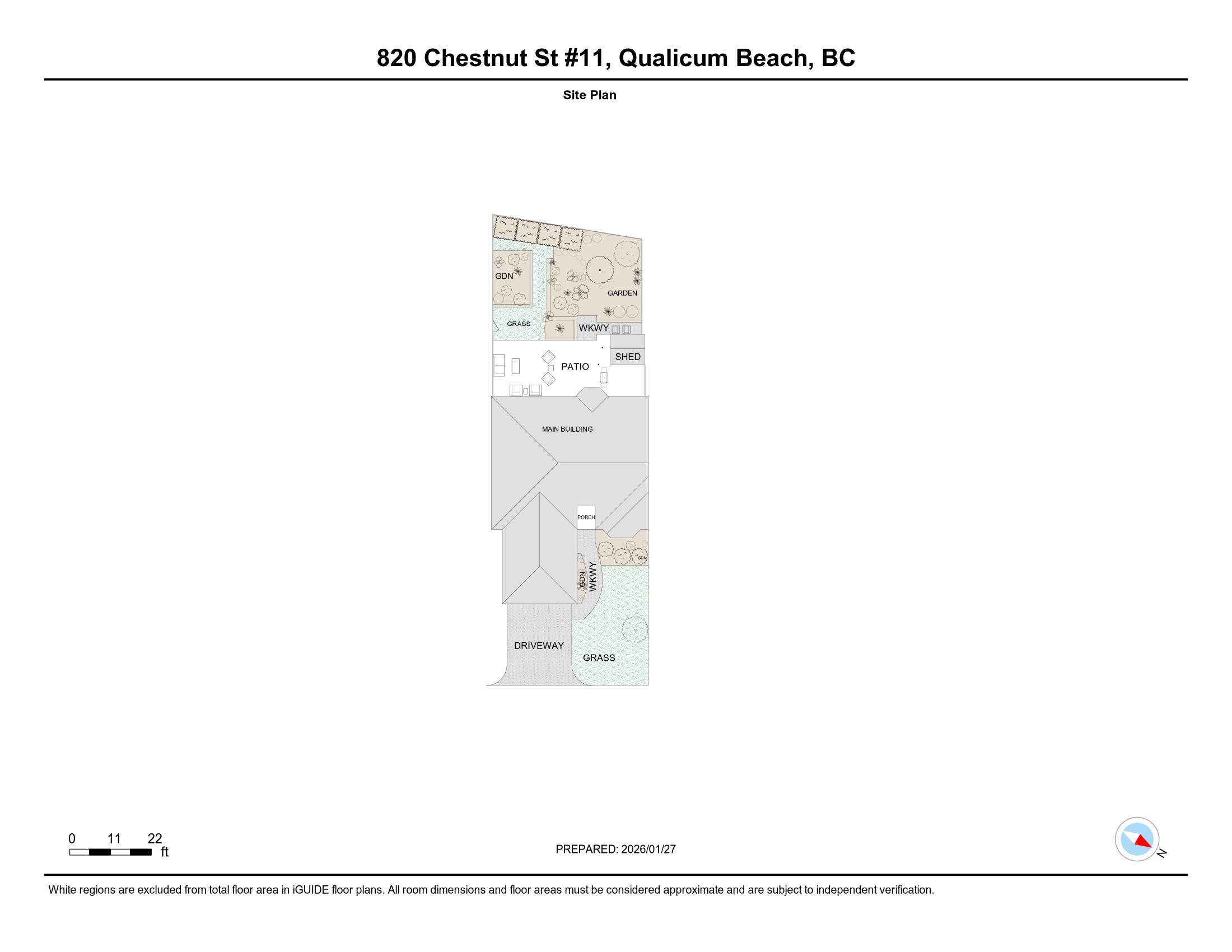
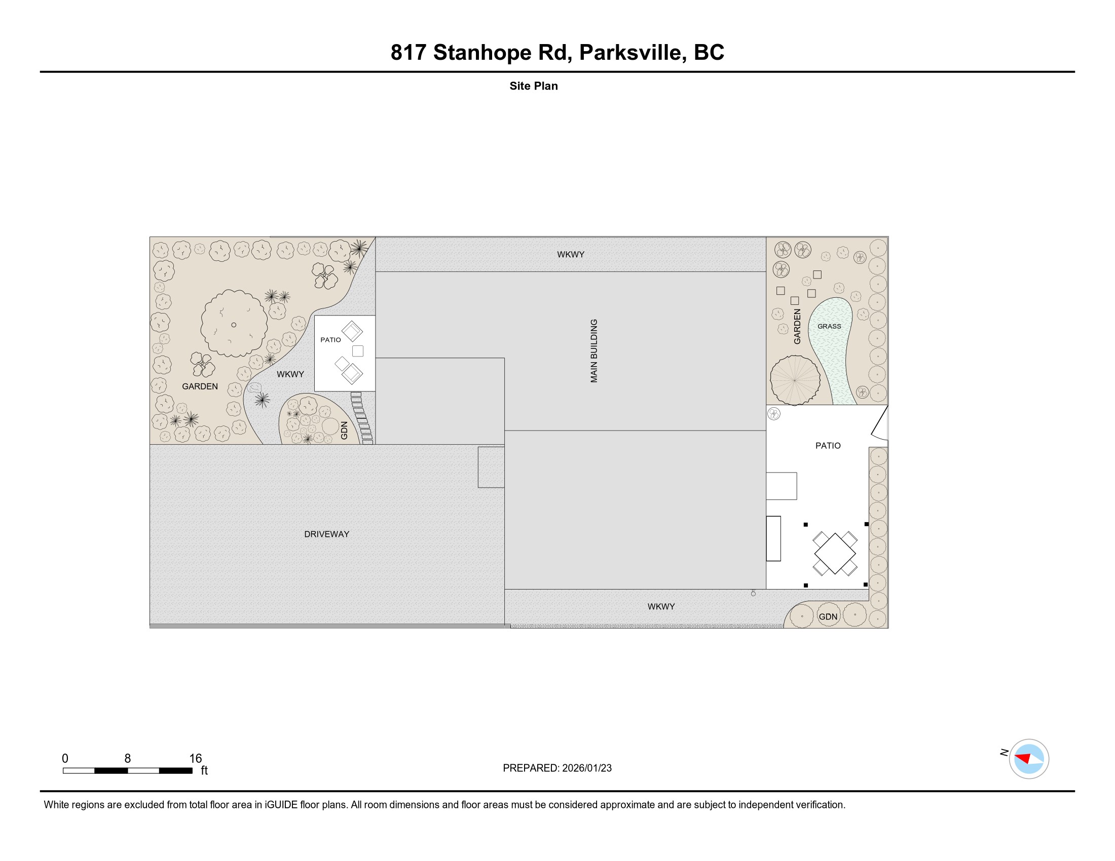
Those look great, Todd. I can see these being popular for the right property and acreages.
Hey Tacey, see https://help.youriguide.com/hc/en-us/articles/31750534949394-iGUIDE-Site-Plans for details.
I believe it’s technically still in beta but will be officially launched this week.
Awesome example Todd.
What is the Workflow to add this to the scan process?
I just now saw the link above. ![]()
1 Like
I often do a few panos outside each door. Essentially there are a few more visible panos and some extras so the drafters can see all features. For a standard yard maybe 5-7 minutes extra.
Does the site plan include the objects (tables, trees, etc) in both the standard and premium offering? Or, is it limited to the premium?
I have done one, and I think it turned out really well. I’m having a bit of a struggle, adding it to my products and services menu, considering has to be part of the iGUIDE package but certainly not for every property.
Hi JBDE,
The Help Desk article is a great source of information - https://help.youriguide.com/hc/en-us/articles/31750534949394-iGUIDE-Site-Plans
We do include outdoor objects even when you buy a standard iGUIDE for the base (iGUIDE Premium would have the interior fixtures and furniture included).
- Outdoor Details: Incorporates a library of 40 common outdoor objects (e.g., trees, gazebos, sheds) and 5 area types (e.g., grass, driveway, garden) to make the plan visually appealing and informative.
Hello, Do the site plans carry the same amount of detail regarless of plan? ( Standard vs Premium)
Todd - I added the site plans as an upgrade and used the Dependancies to control when the “Add On” site plan would be displayed based on any package that includes an iGUIDE. Hope that helps.
Yep, we’ve included full detail on both standard and premium packages!
The level of detail is primarily driven by the available data and the size of the property. When there are more scans, our team has more information to work from. Conversely, when there are few or no scans, we rely more on the aerial data sources we have. Similar to the size of the property, when it’s a smaller lot, it allows us to be more detailed. When it’s a larger lot or acreage, then there is naturally less detail to keep the scale.