Hi there… general advise, non-binding, sharing an idea…
I always ask a client in this situation of their good question, " I am interested, but lets ensure we both are thinking the same thing… can you expand on what your asking for and the deliverables?" Then we together define it on a ‘level playing field’…
Google it and you will find several narrow & wide definitions… but the capability is not a part of the current iGuide deliverables at this time that I can see, nor do I have information on.
I think exterior elevations usually are drawings of front, sides and back with how the home is situated within the contour of the lot. If they just mean panospheres which show the front, sides and rear facades, the answer could be “yes.”
I’m guessing the architect is looking for digital cad files of the elevation views. This would be to complement the DXF plan view the iGuide can deliver. Don’t see how iGuide can export for DXF elevation views.
Hi, we don’t currently draft Elevation Plans. But if you scan in the vertical plan (keep the shots aligned as if you were cutting a Vertical Plane through the house), you can align the shots in Stitch, then output a DXF of the points using RADIX and complete the project as required.
Rob,
According to the pricing chart online iGUIDE Processing - iGUIDE®, DXF and DWG files are not possible with Radix. Do we have to process with Standard or Premium?
Hi Tim, You can certainly use DXF output for Radix files, it’s been around for years that way. There is NO compatibility with DWG’s for a variety of reasons. Send me an email to rjohnston@planitar.com and I can send you a sample Radix-DXF file of an Elevation Plan I did.
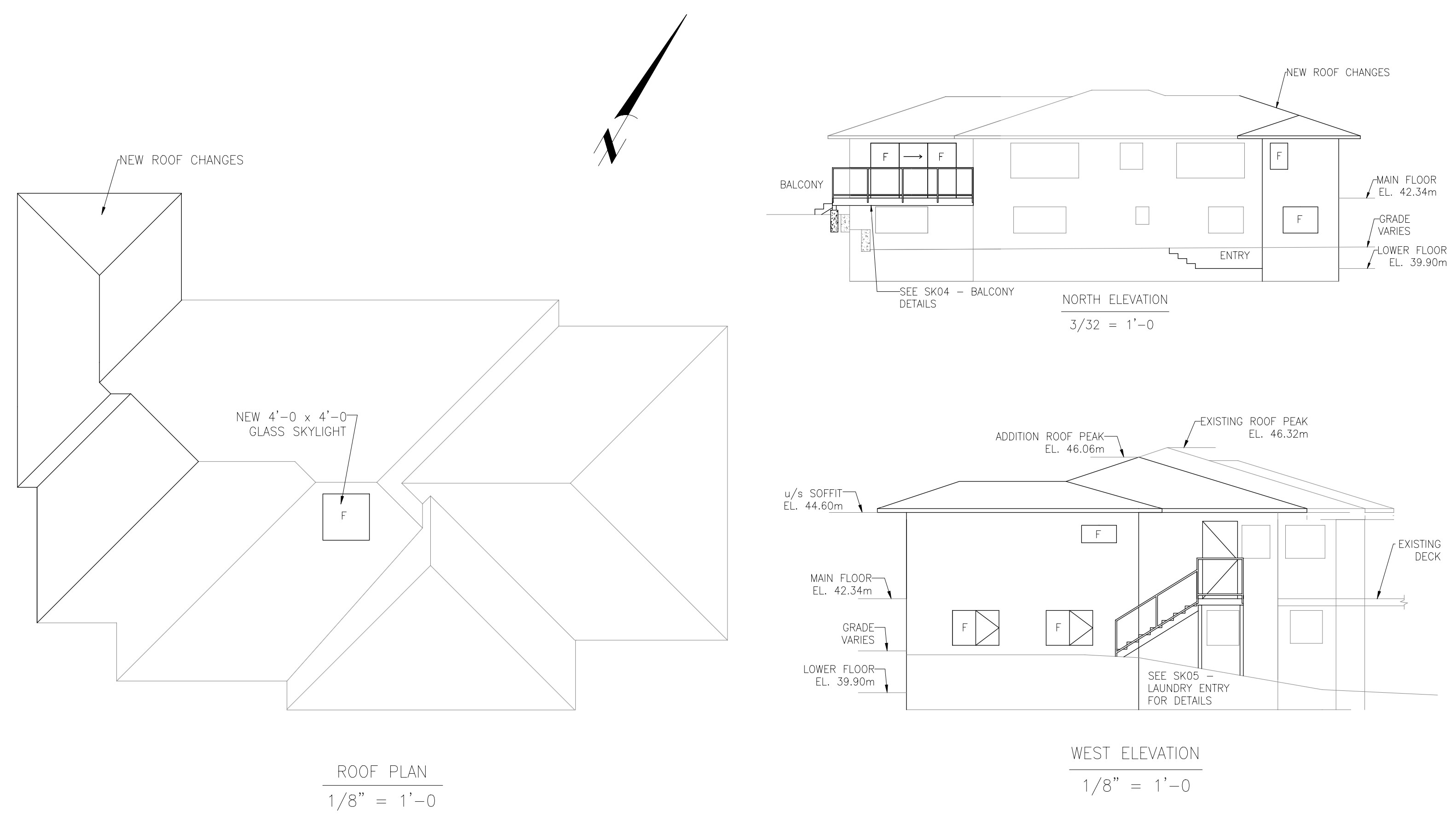
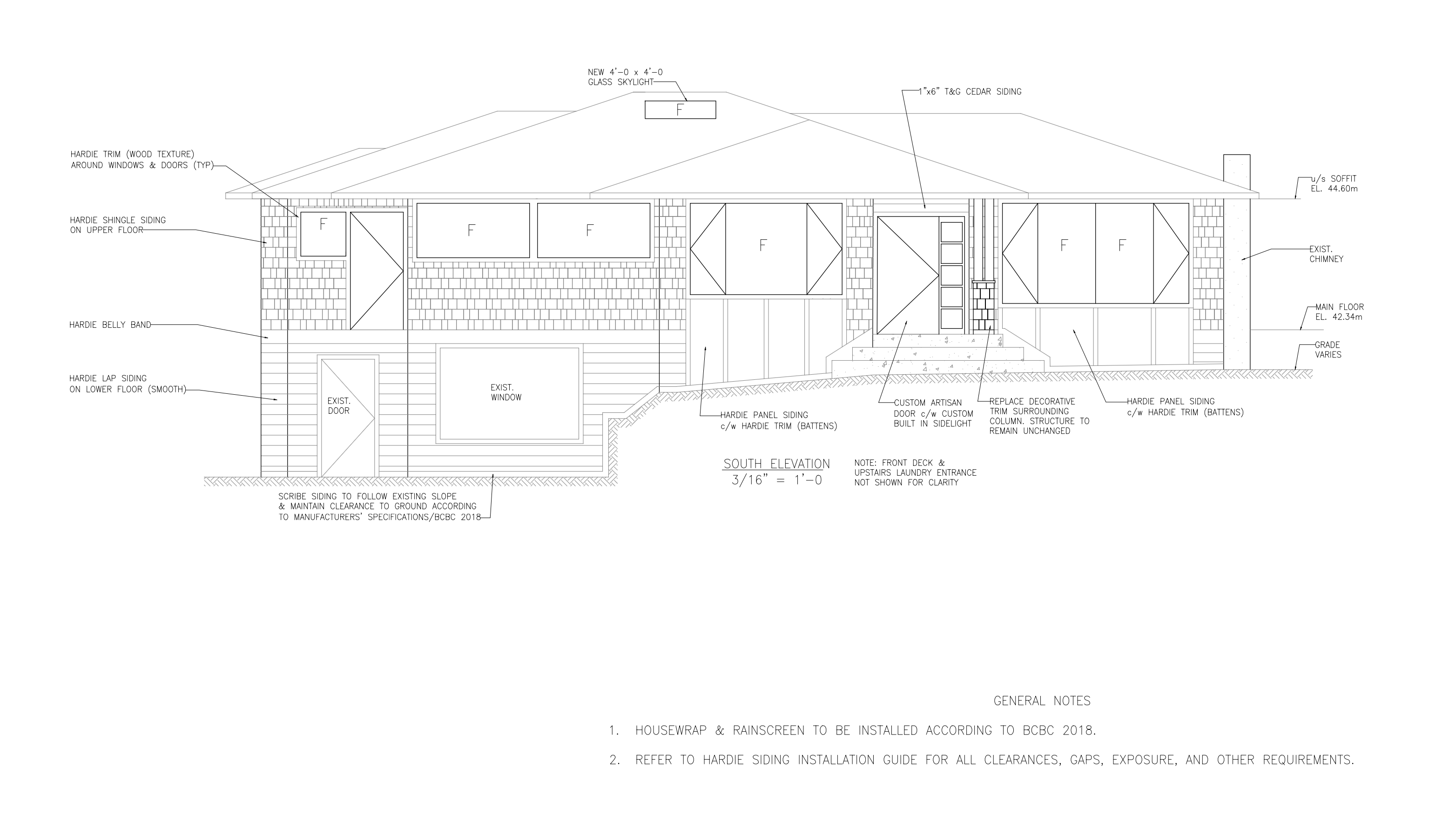
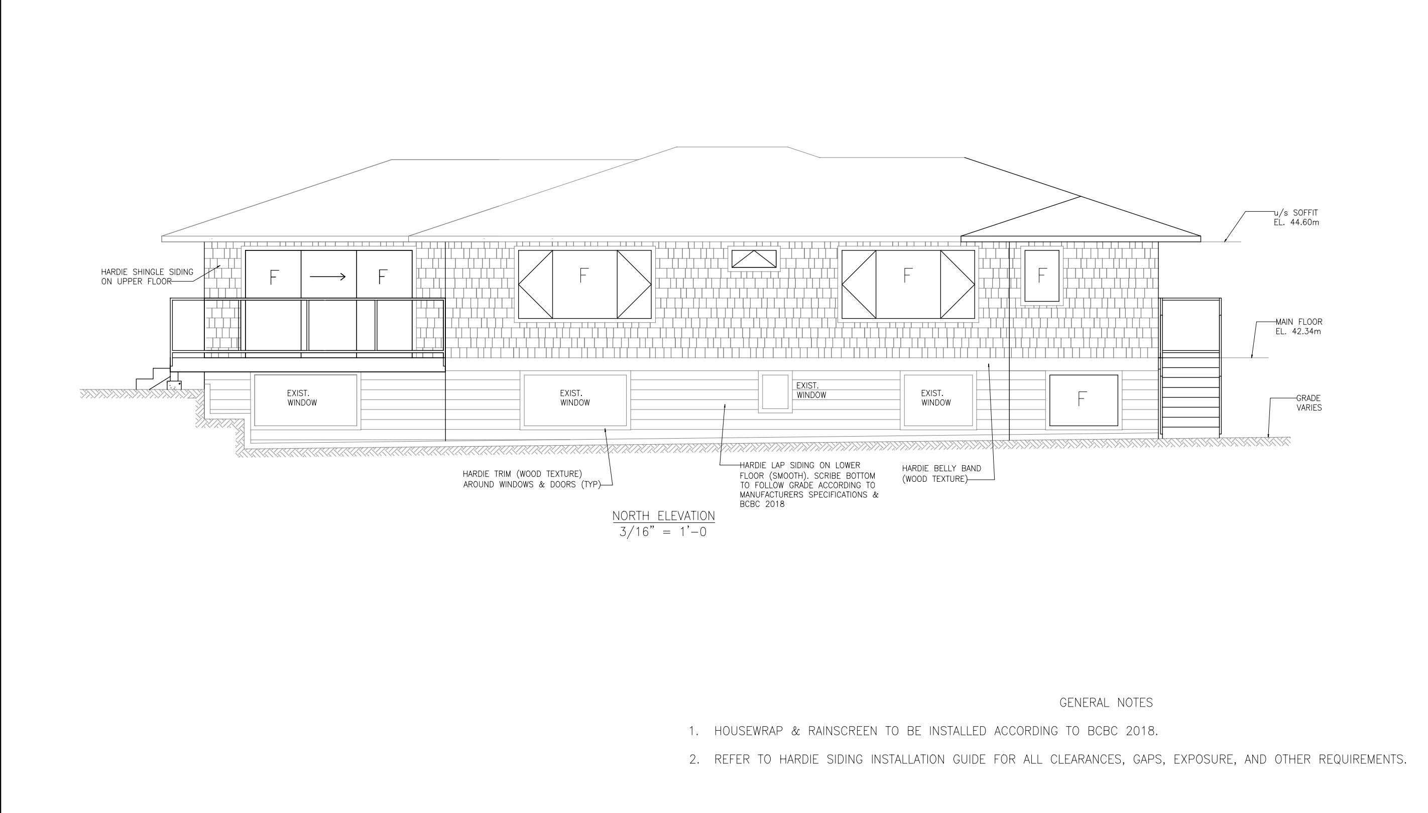
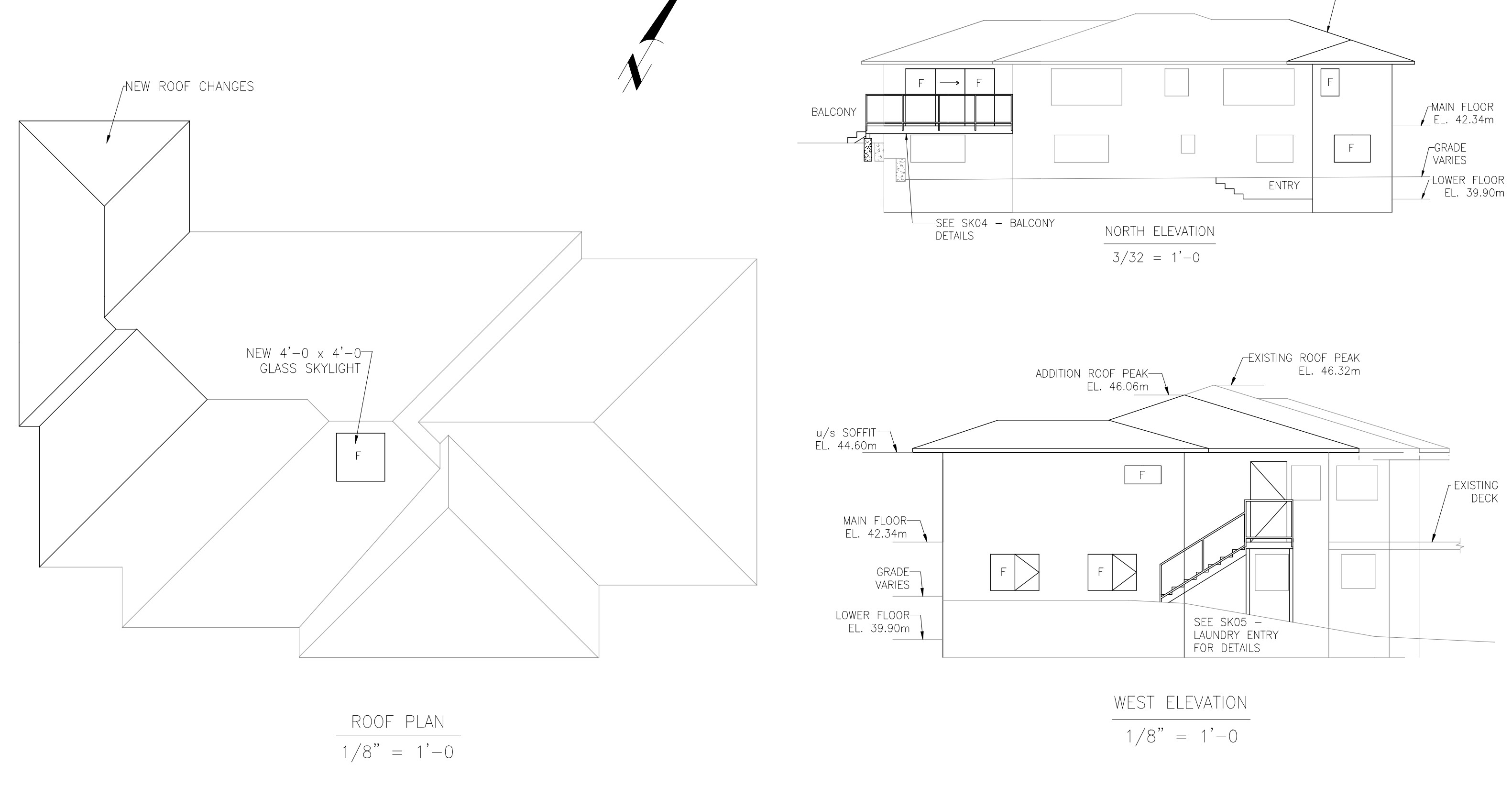
Elevations are usually handled by the draftsperson for the architect or structural engineer. Please see attached the excerpts from a handful of documents included in the building plans for a home I worked alongside with from renovation, to it’s sale.
The municipality requires elevations not just for the site itself but depending where you are at in the world, they will require elevations at sea level, and may even require more information such as window and door schedules, cross sections, etc.
If your client is a renovation company and is asking for these, you will either have to ensure you are absolutely certain you know what you are doing or refer to an engineer to handle the remaining aspect of the DWG plans you are likely working with.
If this is outside of the MLS and you are now doing floor plan drafts for municipal submissions, please proceed with caution and ensure your general liability policy extends from MLS inaccuracies and discrepancies (despite “Measurements are Approximate” disclaimers – those don’t work if it has been proven you were negligent in recording the information to begin with) to actual blueprints for building homes. There are certain guidelines and minimum requirements that are needed for this information to even be accepted, and that’s the need for an architect or engineer to take it from here…
I’d hand the DWG files over to their architect. If they are a renovation company they should either have an engineer on staff or at the very least, a draftsperson.
Just my two cents.
As an example, I have attached the building records that were submitted to the municipality that were eventually accepted, and the home was extensively renovated.
What program did you use for capture? I am interested in using something like Hover, but seems like you would need a drone to capture the roof like you have in your illustrations.