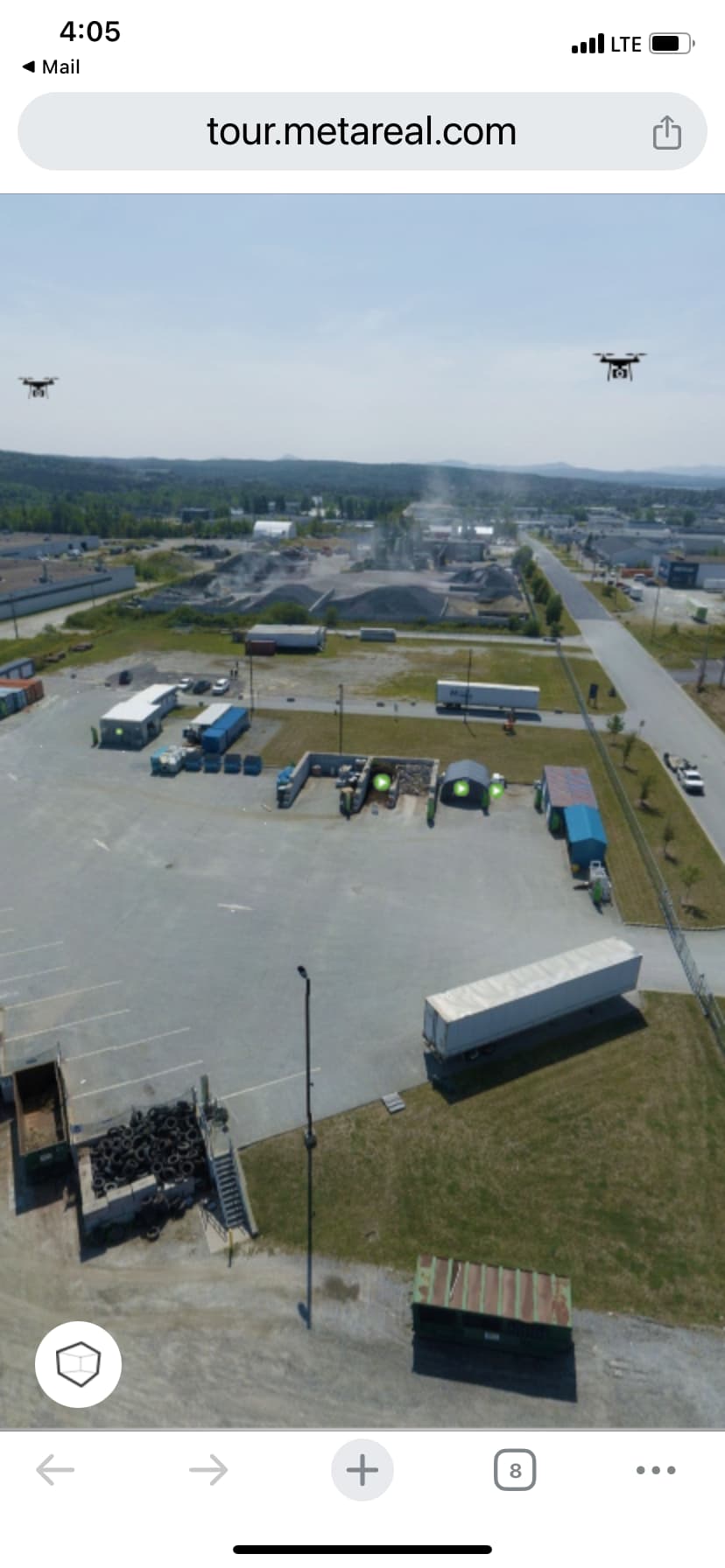
It would be nice if we added aerial exteriors to a floor plan that the “dot” would be somewhat visible. As it is now, it’s a dark green dot on a black background and NOBODY sees it. I knew it was there and I couldn’t see it!
It would be nice if it had a background contrasting behind the word “aerial” and the dot so at least a viewer could see it!
I always thought that something like the stairs icon for going up or down would make a good indicator by a door/window/patio door etc.
White icon with a picture of a drone.
I’ve just started to put any drone panos on their own “floor”. When the viewer changes floors, they will see there is a floor called Drone View, encouraging them to explore it.
Also, you don’t get that silly “aerial” label on the floor plans, and the navigation dots are of no concern. They never make sense anyhow.
This is one I just did. Only had one drone shot, but you can put as many as you want.
I like the idea of putting the drone shot as a separate floor plan. Can you let us know how you create the pano. Is it done in survey when you are capturing the property? Or do you insert the pano in stitch?
TIA
When you add a new floor in Stitch you’ll right-click on the new floor and click add pano from the context menu. When you do that it will ask for the location of the pano image. With aerial you’ll need to have a single pano image already stitched from your drone.
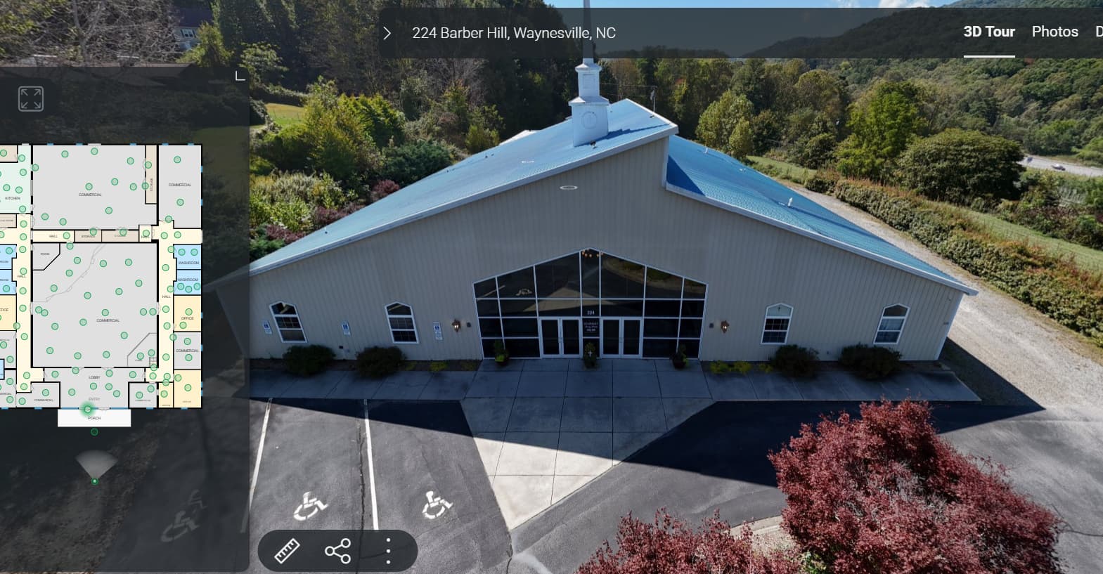
Has anyone accomplished adding “Drone/Aerial” to the actual Tour yet? If so, do you have a link so we can see it? I can’t visualize it in my mind at all.
I just tried adding aerial drone panos to today’s shoot, and Stitch said it cannot, as it exceeds the total of 256MB allotted for the file. I ran the pano through LR and reduced the output size to 15MB, but still the same response. Anybody got any ideas as to why?
Do you see any of the ground points from the aerial? For example the front porch or yard? I’ve got my aerial showing on the main floor, but it doesn’t show any scan points. So if you don’t click on the floor plan you can’t get into the house.
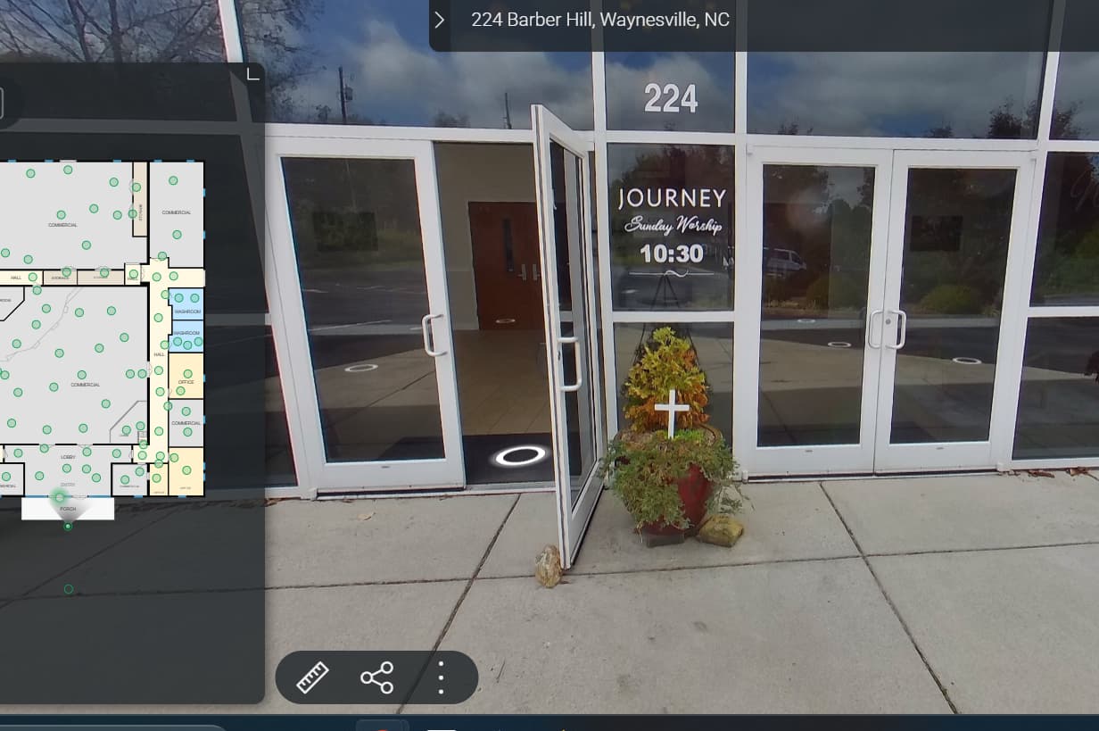
I don’t see any “halos” at all from the aerial but if you click on the front of the building ( a huge church) it takes you to the first ground level pano which is at the front door.